|
 | Home | Visiting Saltaire Home | Saltaire | Walks | Canal walk | Home | Visiting Saltaire Home | Saltaire | Walks | Canal walk |
| Image: Dan Bailey |
|
|
|
|
WALK: A circular walk by the canal and through Roberts Park with a choice of a woodland extension.
| Distance: |
There is a decision point in this walk giving you a choice of distances between 1 and 2.25 miles. |
| Time: |
Allow 45 minutes for the short walk.
Allow 1 hour 15 minutes if you chose the extended walk. |
| Height: |
Relatively flat with one exception. |
| Difficulty: |
The short walk in on pavements, canal towpaths and a short distance on a rough, unmade road.
The extension through the woods is on a good path of sandstone chippings and sand.
There is one sever gradient down to the canal from Victoria Road.
There is one flight of steps, which can be avoided.
Accessible by wheelchairs and pushchairs, though the unmade roads could be uncomfortable. |
| Be prepared: |
Wear good flat shoes with a reasonable sole.
Water hazard! Be vigilant with children by the canal and the River Aire.
A question mark indicates a choice of route. |
| Scenery: |
Passing historic buildings in the World Heritage Site of Saltaire. Canal side towpath, option of woodland walk, option of Roberts Park past the statue of Sir Titus Salt. You could also continue walking along the canal path up to 5 rise locks in Bingley. |
| Location: |
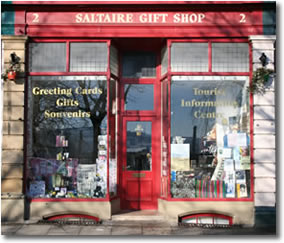
Saltaire, West Yorkshire. Start from outside the Tourist Information Centre, 2 Victoria Road, Saltaire. |
Your walking instructions.
Click on pictures to enlarge them. |
You have a decision to deviate from the walking route, to do the short route or to do the extended route. |
A commentary on the history of buildings, sites, etc. as you pass them. |
|
|
With the Saltaire Information Centre on your left, walk down Victoria Road towards the River Aire.
Click on images to enlarge. |
| |
 History as you walk....
Victoria Road is steeped in history. In 1883, The Tourist Information Centre was a confectioner's shop and the shop next door, at No. 1 Victoria Road, was a flour dealer's. You will go over the railway, which was opened as the Midland Railway in 1847 – 6 years before the Mill was completed. Titus Salt had a siding built into the yard at the front of his Mill so that his finished cloth could be quickly loaded and transported to buyers all over this country and beyond.
There was a station built here when the Mill opened, to enable the workforce to travel from Bradford and other centres before the houses in Saltaire were built. The station closed as part of the Beeching cuts in 1965, but was reopened in 1984 and now proudly proclaims that Saltaire is a World Heritage Site.
 The United Reform Church (previously the Congregational Church) is a Grade 1 listed building and is well worth a visit. It’s still a working church for the Village. Titus Salt and other members of his family are interred in the Mausoleum at the side of the church.
Look down Victoria Road, which used to continue over the river on a wide road bridge. This bridge was demolished in the 1950’s after tanks were driven over it in World War II, seriously weakening the structure.
|
|

|
Walk over the canal bridge, which spans the Leeds/Liverpool Canal, constructed in 1774.
Turn left after cross the bridge, down a steep slope to the canal side. Face the water and turn right, walking away from the bridge, past the waterbus stop. Those with children, please take care – water hazard!
Did you know?
The canal brought bulky raw materials to the Mill, especially alpaca from Liverpool, and coal. |
| |
 History as you
walk....
History as you
walk....
Look across the canal, just after the church grounds there are allotments. They were part of the original plan for the village. Titus Salt obviously appreciated that many of his workers still remembered their rural past – when spinning and weaving were a cottage industry which supplemented the wages of agricultural workers before the Industrial Revolution.
And of course, the villages still relied on allotments for cheap vegetables and meat. Probably the most popular society in the village was the Horticultural Society, formed in 1861 – and later renamed the unlikely, “Horticultural, Pig, Dog, Poultry and Pigeon Society” of 1876.
Look to your right, over the wall. There is a driveway which leads to the cricket ground and club house. Cricket was supported by the Salts Company, and the village had a nationally successful team. Walk further along the canal and notice that you are passing bowling greens and football pitches. There is a story about this land. It had been sold by the Company to Shipley Urban District Council, and the Council allowed workers to have allotments, greenhouses and piggeries on it. However, in 1919, when Sir James Roberts owned the Mill and the village, he wanted to change the use of the land. The story is that he felt that if the workers were giving value for money during working hours, they wouldn't have enough energy left for gardening!! He negotiated with Shipley Urban District Council to repurchase the land – offering to give then Hirst Wood as an incentive to sell. The Council accepted.
|
|

|
Continue walking along the tow path to Hirst Wood Lock. This is a single rise lock which raises the canal by 10 feet 2 inches and is capable of taking boats up to 45 tons capacity.
Did you know?
Canal transport used to be much cheaper than taking goods by turnpike roads. One ton on roads cost £4-10 shillings (£4 50 pence), but only 10 shillings by canal (50 pence). |
|
You have a choice to make
If you are excited by the lock, you can abandon this walk and continue on the canal for another three quarters of a mile to 2 rise locks at Dowley Gap, or past that (1.75 miles) to 3 rise locks in Bingley – and if you walk a further 2 miles you’ll reach the jewel in the crown, 5 rise locks in Bingley. You could always get a train back from Bingley if you don’t want to walk back along the tow path. If you do catch the train back, get off at Saltaire. You'll emerge on Victoria Road. Turn right to return to the Tourist Information Centre.
Or, if you want to do the woodland extension continue with these instructions. If you just want to do the shorter circular walk skip to instruction 9.
Beyond Dowley Gap lock is a swing bridge and this is a decision point for you – whether to extend your walk through woodlands with good paths, or to being your return to Saltaire. To return to Saltaire ignore instructions for the extension walk. |
|

|
To continue with the extended walk, cross the swing bridge. Go into Hirst Wood Car Park on your right. You are about to enter an area of mixed woodland called Hirst Wood.
Did you know?
This used to be the site of Hirst Farm, an 18th Century farmhouse owned by the Earl of Rosse. In 1911 it was sold at public auction. In 1930 it was a shop selling groceries, sweets and afternoon teas and lemonade. It was demolished in 1962. On the opposite side of the road was a lock keeper’s cottage, overlooking the lock. Attached to it was a cottage which became a tea shop, also now demolished. |
| |
History as you
walk....
The area is geologically interesting. 10,000 years ago, a glacier covered most of the Aire Valley. As the ice began to melt, it released the rock debris which had been picked up and carried with it. The glacier stopped and melted for a long period on this site, leaving a terminal moraine of coarse gravel with boulders of gritstone, limestone and shale. You are standing on this bank of mixed rocks which stretched from here to Bingley.
The course of the River Aire was changed by the moraine. Before the ice came, it used to flow where the railway is now built, but the moraine blocked this and diverted the river onto its present bed.
|
|

|
Walk to the wooden gate at the end of the car park and go though the metal kissing gate on to the woodland paths.
Did you know?
There is little sign of human habitation in the woods. In 1950 a stone circle about 30 feet across was discovered, believed to be the remains of a hut or shelter. A few flakes of flint were found.
|
|
The left hand path is less muddy in bad weather and has a direction post and a bench on it – but they both join up over the rise. Walk straight forward on the broad path which rises gradually. Ignore a path to the right. Keep forward past some stones at the top of the rise and shortly see a sign post on your left at a path junction. Ignore the path to the left and keep straight on, past a bench upon which you can rest for a while. |
|

|
The path gradually bends to the right, passing a stone with a hole in it on the left. Also on the left, you can see the river in the distance through the trees. Shortly the path divides and your way lies to the right. As the path flattens out, you will see a tree with a cleft in its trunk and you reach a junction of paths. Your way is to turn sharp right, almost back on yourself. The path levels and begins to descend. The canal is now on your left through the trees bit is out of sight. Pass a large tree with prominent boles on its trunk on the right and then there is a dead tree with lopped off branches on the left. |
|
You soon meet up with the path which you came in on. Bear left, back to the car park and retrace your steps over the swing bridge to your left to the canal path. Turn right and follow the canal back to Saltaire. [End of extension walk.] If you wish to retrace your steps at this point, turn right and follow the path by the canal to Saltaire. Alternatively, if you wish to walk back via Roberts Park with a peek at Hirst Mill, go to instruction 10. |
|

|
From the Garden Centre side of the tow path by the swing bridge, go down the rough road which runs directly from the bridge, with the Garden Centre on your right. Pass the houses on Hirst Mill Crescent on your left. We've brought you down here to have a look at Hirst Mill which is at the end of this Private, No Through Road. [There's another view of it from the other side of the River Aire - which is another walk worth taking.] |
| |
 History as you
walk....
History as you
walk....
There has been a mill on this site since 1740, initially grinding corn, but then used as a paper mill. In 1872, Sir Titus Salt bought the mill and nearby houses, and let the mill out to a series of tenants.
In 1893, the tenants were cloth washers and scourers, washing industrial cleaning cloths, trading as “Machine Towels”.In 1920 the tenant was a flockmaker who produced mattresses.
In 1953, the tenants were a combing firm who produced tops from alpaca, mohair, yak and human hair (from China!). In 1968 the mill closed and in 1970 was converted into flats.
|
|
Turn around and retrace your steps towards the canal again, but before you reach it you should turn left and walk along the unmade road until you come to a junction of paths and a large dome shaped structure which is part of the Water Board. Cross the bridge on your left hand side.
Did you know?
The iron girder structure on your left as you cross the bridge, carries 2 water pipes. The first was laid in 1880 to supply water to Shipley and Baildon. It brings water from the Graincliffe reservoir on the edge of Rombalds Moor, near Eldwich. A second pipe was laid alongside it in 1932. A larger aqueduct was built across the river in 1860 and carries water from Burnsall to Bradford. This 18 mile pipeline provided one of Bradford’s first supplies of clean water and delivers water to the service reservoir at Heaton. |
|

|
Continue straight forward towards the houses and then turn right along the path in front of the housing. This is a good surfaced pathway with street lights, which continues around a left hand bend, when you can decide whether to ascent a steeper slope via steps or a gradually climbing path towards a telephone box and then to the top of the steps. Continue along the flat until you see a wall straight ahead. There is a path through a low wall to the right, but you should ignore this and head for the high wall in front of you. Turn left when you reach it and rise up on flagstones to turn right at the top. This is Roberts Park which was opened in 1871. |
| |
 History as you
walk....
History as you
walk....
In 1920 Sir James Roberts gave the park to Bradford Council as a memorial to his son, Bertram. You are at the end of a broad promenade, part of the formal gardens built by Sir Titus for the recreation of his workers. A large statue of Sir Titus is situated half way along the promenade. It was donated by James Roberts in 1903 to celebrate the centenary of Sir Titus’ birth.
Note that the statue is facing away from the mill and the village. This is not meant to indicate that Sir Titus was ashamed of his creation. Rather than this, he is looking benevolently down on his workers as they enjoy this important recreation site – which used to have a bandstand and 2 large cannons which had been used in the Russian War and at the Battle of Trafalgar. The cannons were melted down for munitions as part of the War effort in World War II. Beneath the statue is a refreshments room. Notice the range of specimen trees and shrubs planted along the walkways in the Park – especially the holly trees which were Sir Titus’ favourites.
|
|

|
At the end of the promenade, turn right, in front of a large shelter and a lodge house, which are being renovated as part of Bradford Council’s programme of improvements. Walk forward over the river bridge, past the weir and New Mill above it. This was the site of Dixons Mill, the original mill at Saltaire. |
| |
 History as you
walk....
History as you
walk....
Dixons Mill was a corn and fulling mill. New Mill replaced it in 1868 and the chimney is a copy of the campanile of the church of Santa Maria Gloriosa in Venice. It is not NHS offices and 143 luxury flats.
 On the right side of the bridge, the river was specially widened by Sir Titus Salt for boating and swimming. A steam launch, the “Rose of Saltaire” provided river trips for the Victorians and they could also hire rowing boats from the boathouse (now a pub and restaurant). Swimming was also popular, although the villagers were shocked by the Italian women who worked in the Mill in World War II and swam in the nude.
|
|

|
You are now back on Victoria Road. You'll see Salt's Mill on your left. Walk up and the Tourist Information Centre is on your right, back where you started. |
| |
Disclaimer: Saltairevillage.info website tries to ensure that the information contained on this web-site is correct and up-to-date, but does not give any representation or warranty as to the accuracy, adequacy or completeness. The website is run on a voluntary basis.
In addition saltairevillage.info cannot be held responsible for the actions of other persons outside its control who may use information obtained from the web-site. |
| |
|
|
|
|
|